
Hi there!
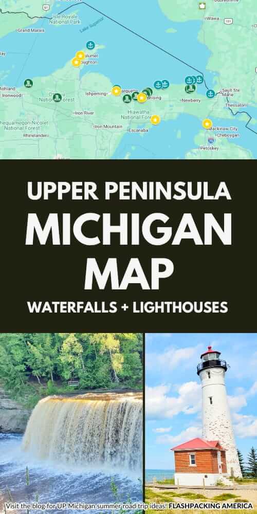
Your Upper Peninsula road trip can be all about waterfalls and lighthouses! Below I have for you an interactive map that includes waterfalls and lighthouses that can be perfect for a circle-the-UP road trip. But first, I want to let you know what’s on the map!
📌 Save this post for later! Save on Pinterest! 👈📌
There are partner websites included on this page.
So, here’s what’s on the map!
If you want to go straight to the map, here you go: Upper Peninsula waterfalls and lighthouses map
- Tahquamenon Falls State Park (lower falls and upper falls)
Pictured Rocks National Lakeshore
- Sable Falls trailhead
- Waterfalls and colorful rock beach!
- Chapel Falls trailhead
- Waterfalls and Chapel Rock aka a tree on a rock!
- Elliott Falls parking
- Waterfalls at the end of the beach that flow into Lake Superior
- Miners Falls trailhead
- Munising Falls trailhead
- Alger Falls roadside stop
- Wagner Falls trailhead
- Scott Falls roadside stop
- Laughing Whitefish Falls trailhead
Lighthouses
Eastern Upper Peninsula
- Wawatam Lighthouse
- Small lighthouse in St Ignace
- Point Iroquois Lighthouse
- Whitefish Point Lighthouse
- “Graveyard of the Great Lakes.” The Great Lakes Shipwreck Museum is here so you can learn about it.
- Vermilion Point life-saving station
- This is a “life saving station” and not a lighthouse. A more remote area and a drive on a dirt road to get here. Go for a long walk on the beach!
- Crisp Point Lighthouse
- There’s a dirt road to get here
Grand Marais, Pictured Rocks, Munising, Marquette
- Grand Marais harbor light stations
- These are small light stations, and there’s an outer light and inner light
- Au Sable Lighthouse trailhead
- In Pictured Rocks National Lakeshore. Around a 3 mile round trip hike.
- Marquette Harbor Lighthouse
- Presque Isle Harbor breakwater light station
- A small light station at Presque Isle Park. This can be one of the stops you make between Munising and Marquette.
Western Upper Peninsula
- Eagle Harbor Lighthouse
- This is the Keweenaw Peninsula. You can make easy stops between Eagle Harbor and Copper Harbor.
Lake Michigan
- Manistique East Breakwater Lighthouse
- Manistique is a gateway to the “big bubbling spring” aka Kitch-iti-kipi.
UP towns to look for hotels in
St Ignace: St Ignace is the first town in the UP across the Mackinac Bridge. You can get a ferry to Mackinac Island from St Igance (as well as from Mackinaw City on the other side of the bridge). Search for St Ignace hotels.
Paradise or Newberry for day trips to Tahquamenon Falls, Whitefish Point, Crisp Point, and/or Vermilion Point. Paradise is about a 20 minute drive to Tahquamenon Falls, while Newberry is around 30 minutes. Paradise is closer to Whitefish Point (15 minutes) and Vermilion Point (30 minutes). From Newberry, it’s a little over an hour to Whitefish Point, and close to 1.5 hours to Vermilion Point. (Crisp Point is not much different, at a little over an hour from both towns.) Newberry has more hotels so you may find more options there. Search for Newberry hotels or search for Paradise hotels.
Sault St Marie: The “big city” near Tahquamenon Falls is Sault Ste Marie at around 1.5 hours. Be sure to look for Sault Ste Marie hotels in Michigan, as there’s a city of the same name in Canada across the border.
Munising: Main gateway town for Pictured Rocks National Lakeshore. Search for Munising hotels.
Marquette: Biggest city in the UP. Don’t miss the Sugarloaf Mountain hike. Search for Marquette hotels.
Houghton and Calumet are in the Keweenaw Peninsula. Search for Keweenaw Peninsula hotels.
The Ontonagon and Silver City area can be a good base for the Porcupine Mountains, but accommodation options are quite limited.
Ironwood is 45 minutes to an hour away from the Porcupine Mountains with more hotel options. 1 hour 20 minutes from Bond Falls. Search for Ironwood hotels.
Manistique: For your circle the UP road trip, you can head to Manistique to complete the circle! You can stop by the “big bubbling spring” aka Kitch-iti-kipi. Search for Manistique hotels.
Cabins and vacation rentals: You can also search for vacation rentals in the UP. Look for the “view map” option.
I have not included it on the map, but for campgrounds, see Lake Superior campgrounds or Upper Peninsula campgrounds.
UP driving route
A sample driving route that you can take is:
Tahquamenon Falls/lighthouse day trips (Newberry/Paradise overnight) > Grand Marais (stop along the way, one gateway to Pictured Rocks) > Drive through Pictured Rocks > Munising (overnight, main Pictured Rocks gateway town) > Marquette (stop along the way or overnight) > Keweenaw Peninsula (Houghton/Calumet overnight) > Bond Falls/Porcupine Mountains (Ironwood/Ontonagon/Silver City overnight) > back towards Mackinac Bridge and stop by Manistique/Kitch-iti-kipi
Grand Marais: See easy things to do in Grand Marais (making a 1-2 hour stop along the way) and things to do on the Grand Marais side of Pictured Rocks
NOTE: If you are doing your planning in the winter, some roads may be closed and you won’t get proper driving directions. For example, in the summer you can drive from Grand Marais to Munising through Pictured Rocks, but it won’t show that in the winter.
Sample overnight stops:
- Overnight Newberry/Paradise: Tahquamenon Falls/lighthouse day trips
- Stop along the way: Grand Marais, a gateway to Pictured Rocks and drive through Pictured Rocks
- Overnight Munising: main Pictured Rocks gateway town
- Stops along the way: Munising to Marquette
- Overnight Houghton/Calumet: Keweenaw Peninsula
- Overnight Ironwood: Porcupine Mountains/Bond Falls
- Overnight Manistique: Stop by Manistique/Kitch-iti-kipi on your way back towards Mackinac Bridge
UP waterfalls and lighthouse map
👆 Explore the interactive map of the Upper Peninsula that I created! Zoom in to get started and click on the icons for details. If you’re having trouble viewing the map, you can view it directly in google maps.
Upper Peninsula road trip ideas > Waterfalls | Lake Superior lighthouses | Campgrounds
There are partner websites included in this post. I may earn a commission.