
Hi there!
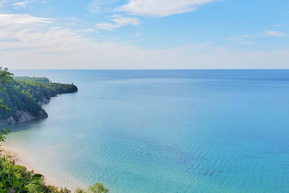
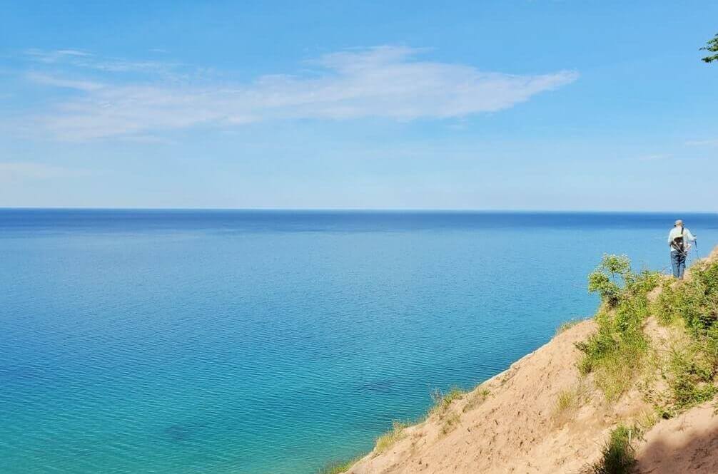
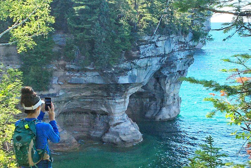
One of the best overlooks at Pictured Rocks that you hike to is Grand Portal Point.
You get there by hiking the Chapel Loop Trail.
It is actually just one of the many beautiful overlooks that you will see as you are hiking the Pictured Rocks cliffs along Lake Superior on the Chapel Loop Trail!
The Chapel Loop Trail is the longest popular day hike in Pictured Rocks.
The North Country Trail is actually the longest hiking trail that goes through Pictured Rocks, but that is not limited to only Pictured Rocks.
That is a trail that will take you all the way across Michigan and beyond!
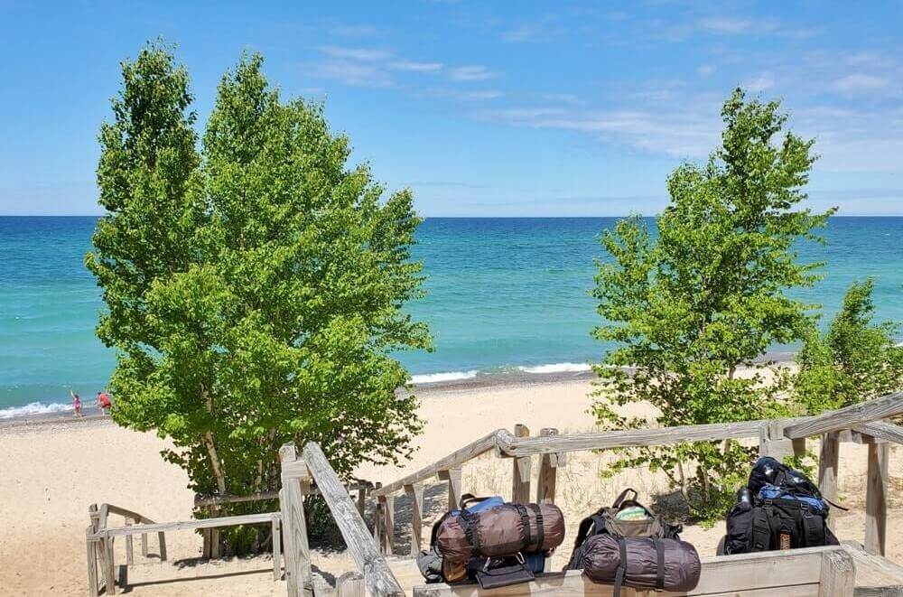
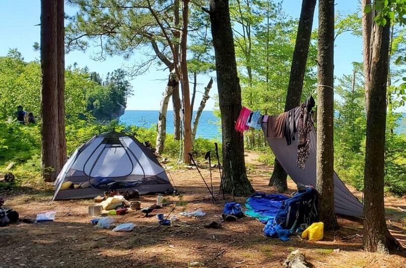
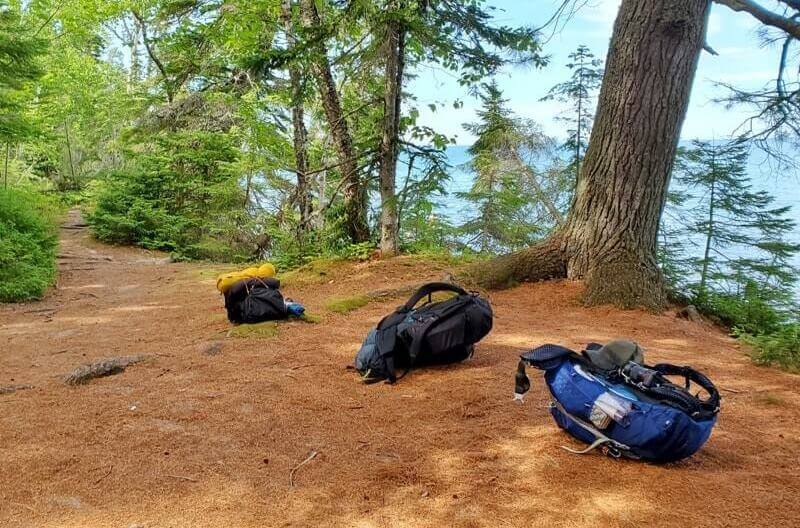
Many people do multi-day hikes through Pictured Rocks which can include backcountry camping along Lake Superior.
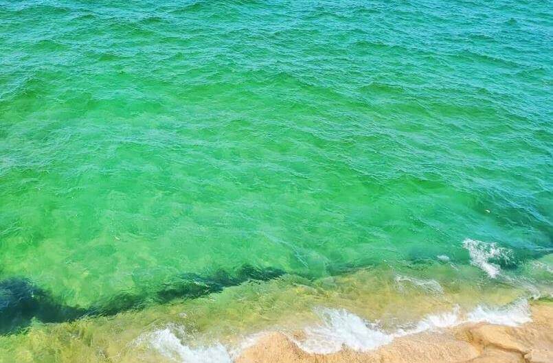
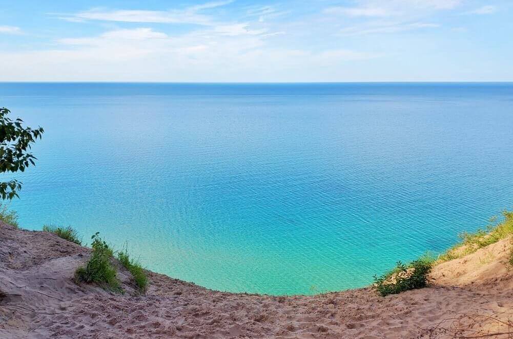
Pictured Rocks National Lakeshore is famous for its Lake Superior shoreline.
And, it’s possible to see grand views of that Lake Superior shoreline by hiking in Pictured Rocks!
Some of the best hikes in the Upper Peninsula, and the best hikes in all of Michigan can be found in Pictured Rocks!

The North Country Trail in Michigan’s Pictured Rocks
The North Country Trail is a hiking trail (backpacking trail) that goes for 4,700 miles from the midwest to the east coast.
And yes, this North Country Trail also goes through Michigan, and it also goes right through Pictured Rocks!
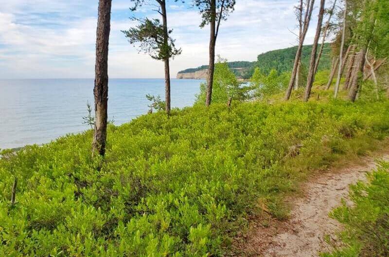
In Pictured Rocks National Lakeshore, the North Country Trail runs for a large part almost directly along Lake Superior, and this makes for grand lake views as you are hiking!
In total, you can hike around 40 miles of the North Country Trail in Pictured Rocks.
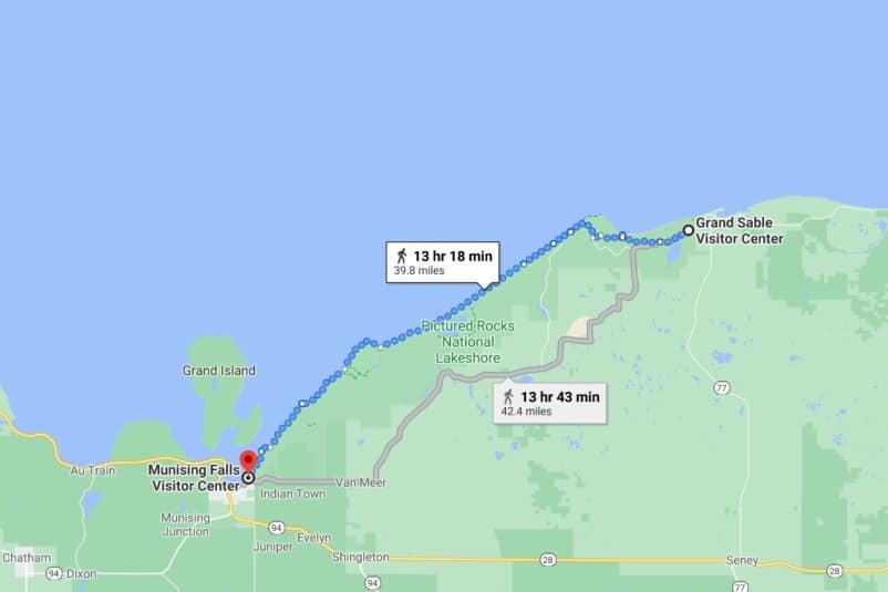
Explore the map.
You can make it an overnight hiking trip, multi-day hiking trip, or “just” a day hike along the North Country Trail!
No matter which you choose, there are epic views to be seen while hiking along one of America’s national lakeshores!
The list below of best hikes in Pictured Rocks will focus on day hikes of varying distances. Many of these hikes include hiking along the North Country Trail.
Hiking the Pictured Rocks cliffs can be dangerous!
In short… stay away from the edge!
The Pictured Rocks shoreline continues to change today because of water levels, crashing waves, and erosion.
In recent years, there have been sightings of large chunks of rocks falling into the lake. (For example, news story and video.)
The Pictured Rocks cliffs most recently crumbled into Lake Superior in June 2021.
This is said to have happened to the cliffs between Miners Beach and Mosquito Beach: VIDEO.
This is another example of how unstable the edges of the cliffs can be… so don’t get too close to the edge when you are hiking!
You can also see evidence of eroding cliffs and dunes in places as you are hiking along the Lake Superior coastline in Pictured Rocks.
Read more about the Pictured Rocks geology (pdf) from the State of Michigan.
Cost of hiking in Pictured Rocks National Lakeshore
According to the National Park Service:
To access Pictured Rocks National Lakeshore, you must possess and display:
Pictured Rocks 7-Day or Annual Entrance Pass
OR
America the Beautiful Pass (Annual, Military, Fourth Grade, Senior, or Volunteer).
If you already have an America the Beautiful Pass, you do not need to buy a separate Pictured Rocks Entrance Pass!
The Pictured Rocks entry fee will cover all hikes in Pictured Rocks National Lakeshore.
The cost to visit Pictured Rocks in 2023 is $20 per car. This will get you a 7-day Pictured Rocks national park pass. (There is no one-day Pictured Rocks pass.)
Confirm current Pictured Rocks fees.
You can buy a Pictured Rocks national park pass at a Pictured Rocks visitor center when you arrive, or you can buy it online at recreation.gov before you go.
If you will also be visiting other national parks that have entry fees, then you may want to look into getting an annual national park pass aka the America the Beautiful pass!
This annual national park pass will also be accepted at Sleeping Bear Dunes National Lakeshore.
Other popular national parks “near” Michigan include Mammoth Cave National Park in Kentucky and Great Smoky Mountains National Park in Tennessee and North Carolina, but these parks do not have a national park entry fee.
If you have several more weeks to spare in the summer or fall, you can make use of the America the Beautiful national park pass by driving out to Yellowstone National Park!
You can go to national parks in Wyoming and national parks in South Dakota, and you could even add on a national park in North Dakota and/or a national park site in Idaho! See how I did the drive from Chicago to Yellowstone.
If you are a senior, there is also an annual national park pass for seniors that will be worth it even if you only visit Pictured Rocks National Lakeshore! It’s $20! See current fees under America the Beautiful passes.
More below for where to go hiking in Pictured Rocks for the best VIEWS along Lake Superior in Michigan!
⚓
Here is a quick list of places to stay for your Tennessee North Carolina road trip, and you can read the reviews at partner website booking.com.
- Sevierville: Serenity, A Rustic Log Cabin Retreat or Berry Springs Lodge
- Pigeon Forge: Twin Mountain Inn and Suites
- Pigeon Forge on a budget: Travelodge by Wyndham Pigeon Forge Dollywood Lane
- Gatlinburg on a budget: Marshall's Creek Rest Motel or River Edge Inn or Gatlinburg Mountain Inn
- Gatlinburg resort: Embassy Suites By Hilton Gatlinburg Resort
- More in Gatlinburg: Greystone Lodge on the River
- Asheville: Princess Anne Boutique Hotel
📌 Pin this post for later! Save on Pinterest! 👈📌
And now…
Best hikes in Pictured Rocks National Lakeshore

Hiking distances approximate!
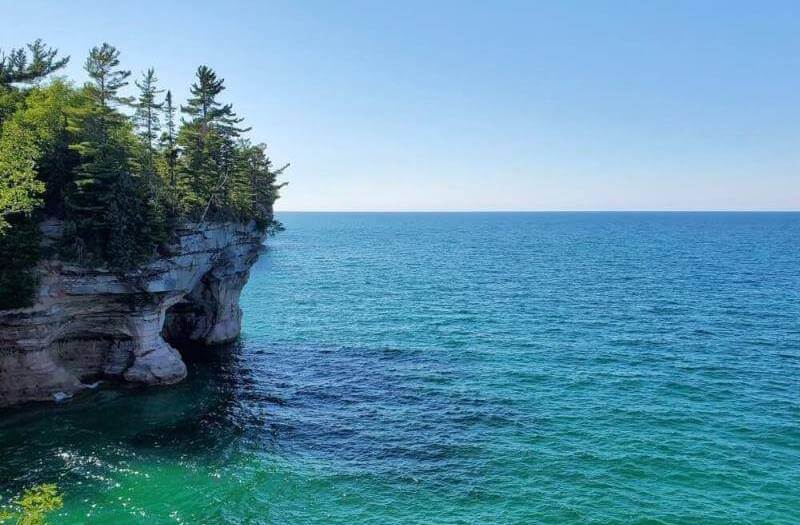
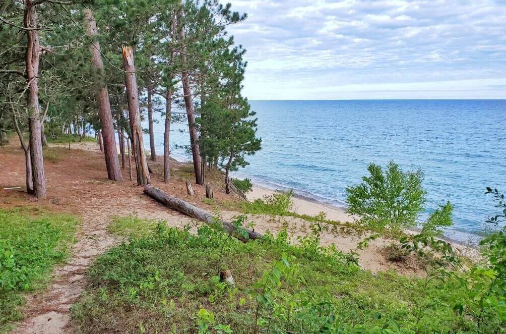
1. Hike the Chapel Loop Trail to see the Pictured Rocks cliffs

- Chapel Mosquito trailhead to Chapel Rock to Chapel Beach: 7 miles round trip
- Hike the Chapel Mosquito Loop Trail: 10 miles round trip
If you are looking for a solid day hike and you are only going to do just ONE hike in Pictured Rocks National Lakeshore, then the Chapel Loop Trail is THE hike you must do in Pictured Rocks!
This is THE hike to do to see the Pictured Rocks cliffs by foot!
This is also called the Chapel Mosquito Loop Trail since you’ll be hiking as a loop through the Chapel area and Mosquito area of Pictured Rocks.
Basically you’ll be hiking from the Chapel Mosquito trailhead to Chapel Beach to Mosquito Beach and then back to the trailhead.
Consider the Chapel Loop Trail to be a loaded hike with tons of views!
You’ll see waterfalls, a rock with a tree growing on it, small waterfalls flowing into Lake Superior, and then lots of Lake Superior views along with the famous Pictured Rocks cliffs!

👆 Hike to Chapel Falls


👆 Hike to Chapel Rock


👆 Hike to Chapel Beach


👆 Hike to Grand Portal Point

👆 Hike to Mosquito Beach
The full Chapel Mosquito Loop Trail is around 10 miles long round trip.
You can also shorten it up a bit by “only” going to one of the other scenic landmarks along the way.
MAP

Explore the map.
See more for planning your Pictured Rocks hiking trip: Getting to Chapel Mosquito trailhead parking lot
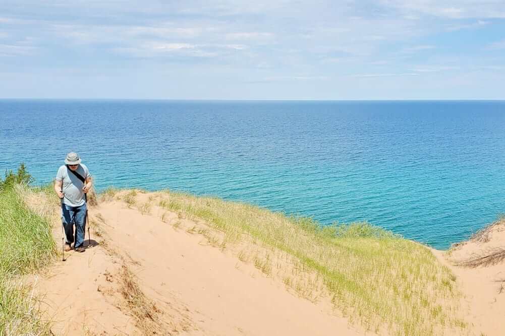
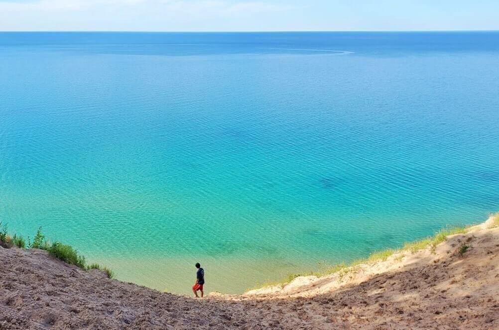
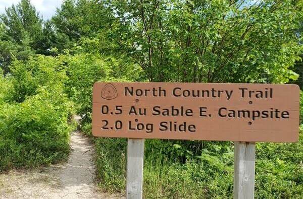
2. Hike from Log Slide Dunes along North Country Trail
- Log Slide Dunes to Au Sable Point Lighthouse: 4.5 miles round trip
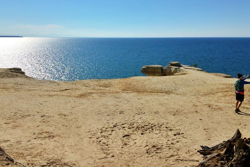
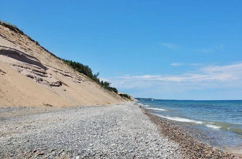
The Log Slide overlook is where you must go if you want to see grand views of the Grand Sable Dunes!

It’s a 5-10 minute walk from the parking lot to get to the Log Slide overlook.
From the overlook, you can hike further along the North Country Trail for a hike with views of Lake Superior!
You can also opt to hike to the Pictured Rocks lighthouse.

Hiking from the Log Slide overlook, you can make the Au Sable Point Lighthouse your destination.
MAP

Explore the map.
See more about hiking in Pictured Rocks: Hiking near Log Slide sand dunes
3. Hike from Miners Castle Point to Miners Beach to Elliott Falls


- Miners Castle to Miners Beach: 3.5 miles round trip
- West end of Miners Beach to Elliott Falls: 1.5 miles round trip
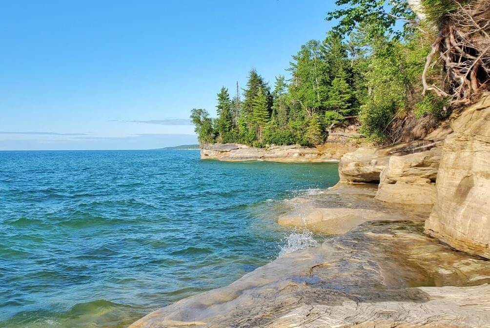
The Miners Castle Overlook is where to go if you want a quick visit to see some unique Pictured Rocks rock formations.
From the overlook, you can hike further to Miners Beach. (It is also possible to drive directly to Miners Beach.)
Once at Miners Beach, you’ll arrive at the west end of the beach, and you can hike along the beach to the east end get to Elliott Falls, which are some small waterfalls that flow into Lake Superior.

Instead of walking directly on the beach, you can also hike along the North Country Trail that runs on top of a small bluff parallel to the beach and comes with views of Lake Superior.
MAP

Explore the map.
See more about planning your Pictured Rocks hiking trip:
4. Hike to Au Sable Point Lighthouse to Log Slide dunes

- Hurricane River to Au Sable Point Lighthouse: 3 miles round trip
- Hurricane River to Au Sable Point Lighthouse to Log Slide Dunes: 7.5 miles round trip
The Au Sable Point Lighthouse is THE lighthouse in Pictured Rocks.
The only way to get to the Au Sable Point Lighthouse is to hike to it.
The main Au Sable Lighthouse Trail starts from Hurricane River.

You’ll look for the trailhead at Hurricane River, and then you will be hiking on the North Country Trail to get to the lighthouse.
You’ll be close to the Lake Superior shoreline and you’ll see signs for “shipwreck” as you’re hiking along. (Although I am not quite sure if these are visible from shore, or if they are only visible from underwater – snorkeling and scuba diving is a thing in Pictured Rocks!)
Once you reach the lighthouse, you can then head back the same way you came, or you can continue onwards on the North Country Trail for more great views.
You’ll get more Lake Superior views, and it will also take you to the Log Slide overlook.
Then, you can head back the way you came. (You can also hike this in the opposite direction, starting from the Log Slide overlook and make your way to the Au Sable Lighthouse and then further to Hurricane River.)
MAP

Explore the map.
See more about planning your Pictured Rocks hiking trip:
5. Hike to Sable Falls and Sable Beach


- Sable Falls trailhead to Sable Beach: 1 mile round trip
The Sable Falls Trail will first take you to a couple of overlooks where you can see Sable Falls, one of the many Pictured Rocks waterfalls.
Then you can continue hiking and this will take you to the Lake Superior shoreline and Sable Beach, one of the many Lake Superior beaches along the Pictured Rocks shoreline.
Sable Beach is where you can find a ton of really colorful Lake Superior rocks in Pictured Rocks. (You might find some in less abundance around the Hurricane River beach too.)
Only look and don’t take, though! As a national lakeshore park, the natural resources that are a part of Pictured Rocks National Lakeshore are protected by the National Park Service.
Also nearby the Sable Falls Trail is the Grand Sable Dunes loop trail which is about a half mile trail where you can see sand dunes.

You’ll see signs for the Grand Sable Dunes loop trail when you’re hiking the Sable Falls Trail.
MAP

Explore the map.
See more about hiking in Pictured Rocks:
6. Hike to Big Star Cove

- Little Beaver Lake campground to Big Star Cove: 3.5 miles round trip
- Little Beaver Lake campground to Spray Falls overlook: 8 miles round trip
The only way to get to the Big Star Cove is to hike to it.
You can access it from the Little Beaver campground, the smallest and quietest of the drive-in Pictured Rocks campgrounds.
There’s a small parking area near the trailhead if you’re not camping here.
You’ll first hike to the Lake Superior shoreline (where you’ll find a sandy beach), and this is about 1.5 miles away.
Then you’ll continue hiking to the left as you’re facing the lake, which is now the North Country Trail, and you’ll come across Big Star Cove shortly after that.
This is a spot in Pictured Rocks where you can basically see the impact of the crumbling cliffs.
If you want to make it a longer hike, you can continue to hike further along the shoreline.
If you do keep going, you can hike to the spot where you can you see Spray Falls from a distance.
This would be around an 8 mile round trip hike. You can also hike to Spray Falls from the other side, which would go past Chapel Beach.
That would be around 10 miles round trip. (Although if you’re on that side, you probably want to hike in the other direction too, since that’s the way to complete the Chapel Loop Trail!)

Out of all the hikes on this list, hiking to the Pictured Rocks coves is the most likely to have the least amount of people.
MAP

Explore the map.
See more about planning your Pictured Rocks hiking trip: Things to do near Little Beaver Lake campground
What to pack for hiking in Pictured Rocks
Most importantly, be sure to bring WATER and SNACKS when you go hiking in Pictured Rocks! It can also be a good idea to have a gallon jug of water or 2 in your car so you can always have easy access to re-fill your water bottles!
If you’re looking for new shoes, then hiking sandals or trail running shoes can be perfect for hiking in Pictured Rocks in the summer!
And that’s a bit about hiking in Pictured Rocks!
There are more short hikes to do in Pictured Rocks too: Waterfall hikes in Pictured Rocks
Plus see the big list of things to do in Pictured Rocks National Lakeshore!
See more about hiking in Michigan:
- Hiking in Porcupine Mountains State Park
- Hiking in Marquette MI
- Hiking in Sleeping Bear Dunes National Lakeshore
More for your trip to the UP beyond hiking in Pictured Rocks
If you’re interested in Pictured Rocks National Lakeshore, then you may also be interested in these things around the UP:
- Tahquamenon Falls (map)
- Kitch-iti-kipi (the bubbling big spring of Michigan!) (map)
- Presque Isle Park (map)
- Porcupine Mountains (map)
- Crisp Point Lighthouse (map)
- Bond Falls (map)
- Things to do in Pictured Rocks National Lakeshore (for views!)
- Best places to visit in the Upper Peninsula (for views!)
HAPPY HIKING IN PICTURED ROCKS!

Top places to visit in Michigan:
- Sleeping Bear Dunes National Lakeshore
- Pictured Rocks National Lakeshore
- Upper Peninsula Michigan
- Porcupine Mountains Wilderness State Park
There are affiliate links on this page. I may earn a commission.